|
|
| HOME | PROTECTION | NATURE | PLAN YOUR VISIT | FAQ | JOIN/DONATE | ABOUT |
| DOIN' THE DOUG - TRAIL GUIDES |
|
Gordon Meadows Trail
|
| Length: 1 mile Difficulty: Easy Elevation Change: 4,030 - 4,290 feet Forest Service Web site (Trail #3394) Gordon Meadows Trail |
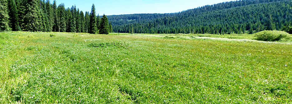
This short trail goes right to the heart of the wetlands meadow known as the Gordon Meadow. There it joins with the Gordon Lakes Trail, discussed at Gordon Lakes West and Gordon Lakes East pages. |
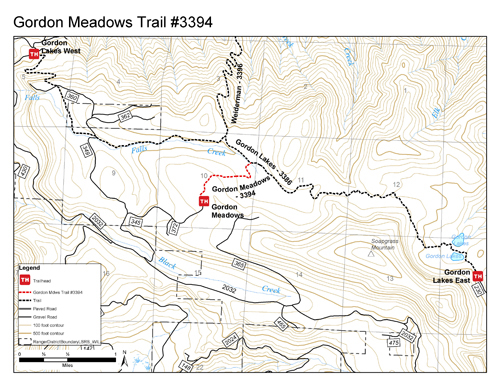 |
Directions: Turn south off Highway 20 at mile 46 onto Gordon Road (Forest Service Road 2032), which is 16.6 miles east of Sweet Home. Travel 8.3 miles on Forest Service Road 2032 to the junction with Forest Service Road 345. Travel 1.7 miles on 345 to the trailhead on the left. |