|
|
| HOME | PROTECTION | NATURE | PLAN YOUR VISIT | FAQ | JOIN/DONATE | ABOUT |
| DOIN' THE DOUG - TRAIL GUIDES |
|
Crabtree Valley
|
| Length: 4.6 miles round trip Note: My pedometer
recorded 5.9 miles to Crabtree Lake and back Difficulty: Easy BUT NOTE: For 2020 This might be upgraded to Moderatly Difficult 800 feet elevation loss (and regain) William Sullivan's guide gives directions to Crabtree Lake. [WS # 19] |
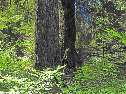
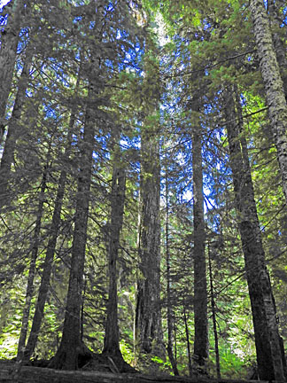
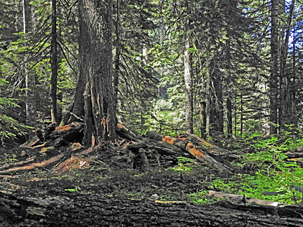
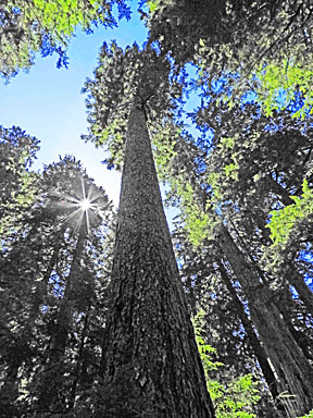
| This area contains perhaps the most glorious old-growth stand
remaining in Oregon. You can take a Google aerial tour of the valley. As the tour slows down you will be looking
north or north east up the Valley. The path to the Valley discussed
below can be seen in the upper right of the picture, running down to
the Valley. The featured old growth forest portion of the Valley is
at the bottom of the picture, so the south of the lake. If the image doesn’t move, click/tap the ‘3d’ button to ‘fly’ around the site.
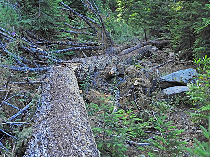
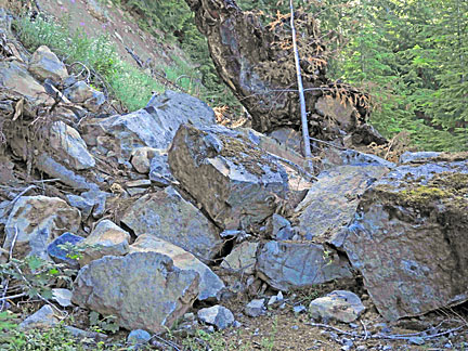
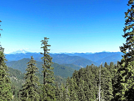
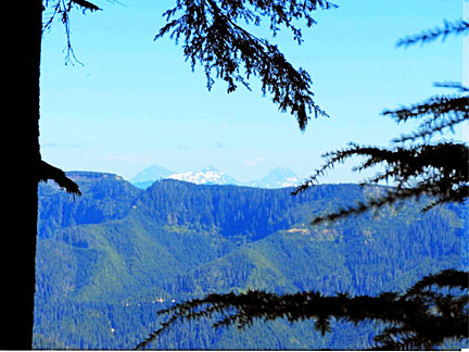
The tree and the boulders cover the trail and fill the space between the cliff on one side and the drop on the other side of the trail. To pass one must climb across or along the tree (diameter up to approximately 4 feet) at least twice, and climb across the boulder pile. There are also a number of gullies crossing the trail where the drop is fairly precipitous and up to five feet up and down. There are a number of trees and bushes establishing themselves on the old road immediately next to the trail, so in some places it is necessary to push through these bushes and alder trees and, mostly, western hemlock. TRAIL DESCRIPTION The trail goes through the end of road parking area, past barriers designed to close the road, onto an abandoned road for 0.3 miles to the pass into Crabtree Valley. This portion of the trail offers views of the old and new cascades, ranging from Mt. Jefferson to Three Fingered Jack and the Three Sisters.
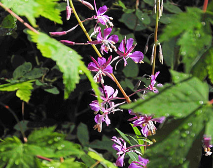
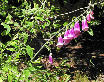
While not as thick as other parts of the Doug, the trail offers wildflowers in season, including numerous rhododendrons, which might bloom before the snow is entirely gone.
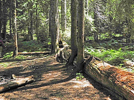
The trail, which is still on an abandoned road, goes 1.1 miles down along a slope into the Valley. At the bottom of the hill is a concrete barricade, covered with rocks and dirt. Turn left at the barricade and climb down onto the small gravel road. Walk 0.4 miles to another concrete barricade. Crabtree Lake is another 0.3 miles, past this barricade and on uphill. The hike along the old road is through an old growth forest, but the edge of the road, and the road itself down from the pass, is not indicative of most old growth forests, because the disturbance of the road. If you get off the road, or look in the right places, you can see the old growth forest of the valley.
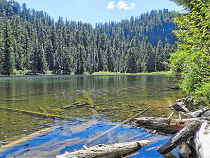
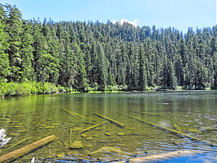
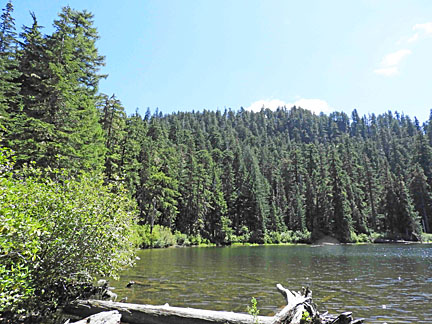
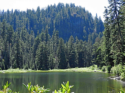
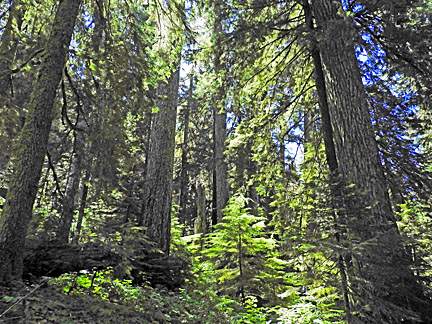
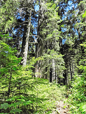
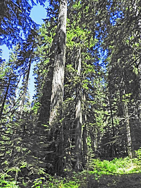
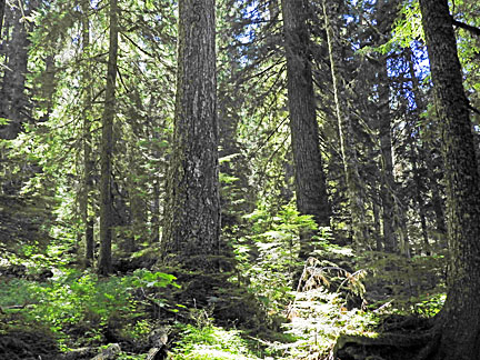
When you get to the lake, you can look across the lake to an undisturbed, magnificent old growth forest.
You can cross the very small creek that is the outflow from the lake and take the trail around the lake. This trail passes into the true old growth forest that you can see when you get to the lake.
You are hiking through an old growth forest, one of the oldest, with perhaps the largest remaining old growth Douglas Fir trees in Oregon. One large tree (270 feet tall, 8 feet in diameter), called Nefertiti, can be reached by crossing the Lake outflow and taking the lake shore trail to its end, about 0.2 miles. The guide books say: "Continue across country, going a little to the left, for 0.1 miles to find Nefertiti." There is now a small but still distinguishable trail that goes from the end of the lake shore trail to the left around a very old nurse log, and then wanders around to finally end at a very large tree that seems to be one of the largest in the area.
Wendell Wood, in "A Walking Guide to Oregon's Ancient Forests" recommends three paths to wander through the woods of Crabtree Valley. Option 1 recommends a sharp left turn when you reach the bottom of the road into the Valley (same as Sullivan), then travel 0.25 miles, where you can see an old jeep road to the left, perpendicular to the path you are on. This old road crosses a small stream and winds among big trees north of the beaver pond. Option 2 starts with the same left turn once you reach the valley. It goes a little further, 0.4 miles, to where you make the first possible right turn. About 0.1 miles further a fallen tree partially blocks the abandoned road. (This tree will have deteriorated some in the thirty years since Wood's book was published.) When you reach the tree, or whenever you wish, you can enter the forest for a cross country hike "through the area's most contiguous old growth grove." (Caution, this is the path towards King Tut, a path that Sullivan describes as bushwacking, and "too rugged to recommend.") Option 3 is the path recommended by William Sullivan and described above. Public pressure saved Crabtree Valley from logging. Including Crabtree Valley into our National Monument proposal will make such protection permanent. DIRECTIONS There are several paths to Crabtree Valley. The one described here is described by William Sullivan, and is the easiest to find. From Sweet Home drive six miles east on Highway 20, then turn left onto Quartzville Road. After 20 miles, you will get to milepost 20 and BLM road 11-3E-35.3 on the left. Turn onto this road, which is a paved, one lane road, and drive 6.4 miles on the paved road. (Don't take the unpaved options at any junctions.) Some recommendations are to park at the T intersection and take the sharp left road. The remaining road is rough and narrow. It is recommended for high clearance vehicles but in August 2020 it is passable by ordinary, low clearance passenger vehicles if you proceed carefully. From the T intersection where the pavement ends, the trail, or the unpaved rough road, takes a sharp left from the end of the pavement and goes a further 0.9 miles to the road end. Some reports show people with high clearance vehicles driving other roads all the way into Crabtree Valley itself. Please avoid doing this; it damages the trail, threatens other hikers, and is insensitive to the experience of the old growth forest. |