|
|
| HOME | PROTECTION | NATURE | PLAN YOUR VISIT | FAQ | JOIN/DONATE | ABOUT |
| DOIN' THE DOUG - TRAIL GUIDES |
|
Echo Basin Trail
|
| Length: 2 mile loop (WS says 2.4 miles) Difficulty: Moderate Elevation Gain: 4,200 - 4,800 feet WS [15] Forest Service Trail #3410 Site: Echo Basin Trail |
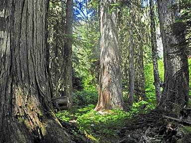
| This is another of the wildflower rich trails to the north of Highway 20 near Tombstone Pass. (The others include Cone Peak and Iron Mountain.) The trail starts in regenerating forest, the result of a clear cut, so the trees are mostly true firs and alder. |
 |
 |
| The trail climbs right away and pretty steeply up to a junction at
about 0.7 miles up the trail (The trail up to near the junction was
once an old logging road - you can see an abandoned cable along and
near the trail). The junction starts a loop trail, which travels
through unlogged groves and brushy meadows. William Sullivan
recommends taking the right branch, which crosses the creek and then
continues up to a stand of old growth Alaskan cedars. Like the ones
along the Cone Peak Trail, these yellow cedar are rare this far
south in the Cascades. The ones visible along the Echo Basin Trail
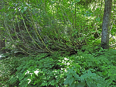
are much older and larger examples than those visible on Cone Peak. Chandra LeGue, in her fine new book, Oregon's Ancient Forests, features the Echo Basin Trail. She speaks of the large silver firs at the edge of a grove of Alaska yellow-cedar: "the true stars of the trail." As she notes, above this grove, there are some large Douglas-fir and a giant yellow cedar, then you enter a wet meadow of tall wildflowers. Parts of the trail are somewhat overgrown. Plank boardwalk have been added in some places through the boggy parts of the meadows. Please stay on the trail here and elsewhere to protect the plants. The trtail eventually turns downhill and back to the start of the loop, then back down to the parking area. |
|
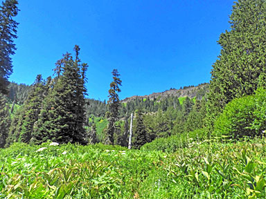
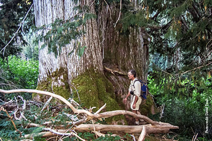 Alaskan cedars by the trail. Photo courtesy of David Tvedt. |
| The cedars are at the bottom of the Echo Basin. The Echo Basin brings to mind a quote from Mary Austin The Land of Little Rain: "They have a better name in the Rockies for these hill-fenced open glades of pleasantness; they call them parks." |
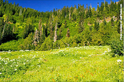 Photo courtesy of LiefPhotos.com |
 |
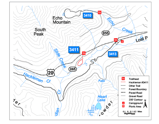 This map shows both the Echo Basin Trail (in black) and the Hackleman Old Growth Trail (in red). They have different trailheads. |
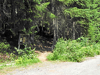
| Directions: Turn north off Highway 20 at milepost 66.8 onto Forest Road 055 (usually marked with an "Echo Basin Trail" marker). From Sweet Home this is approximately 37 miles. (William Sullivan says 39 miles). Forest Road 055 is on the north side of Highway 20, turn onto this rough road and travel 2.1 miles to the trailhead. Parking is on the widened shoulder of the road. Chandra LeGue warns that care needs to be taken on this road if you don't have a high-clearance vehicle. |