|
|
| HOME | PROTECTION | NATURE | PLAN YOUR VISIT | FAQ | JOIN/DONATE | ABOUT |
| DOIN' THE DOUG - TRAIL GUIDES |
|
Santiam Wagon Road Trail System
|
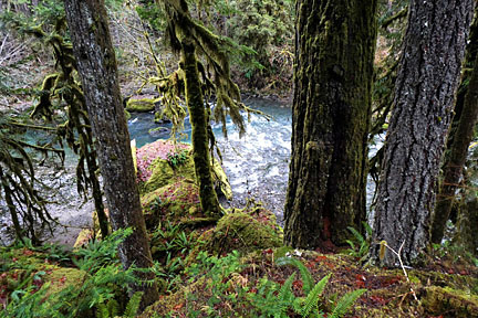
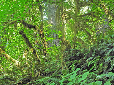
Photos above (top) and to the right, courtesy of Thomas De Keyser. |
 |
| This page covers several trails or trail sections,
all a part of the old Santiam Wagon Road. The beginning and the end
of this group of trails are outside the boundaries of the proposed
National Monument, but portions of all the segments are within the
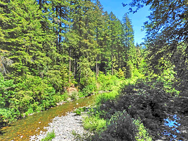
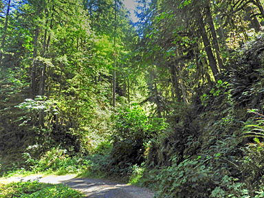
area of the National Monument. The Santiam Wagon Road was one of the original paths across the Cascades developed for non-Native Americans. The road is perhaps unique because it was built and used to transport stock and goods from the Willamette Valley across the Cascades to the mine towns of Central Oregon. The abandoned road (now the trail) runs along the South Santiam River, with several access points off Highway 20. |
Along the trail, especially near the river, you can see big leaf
maples and other moss encrusted trees.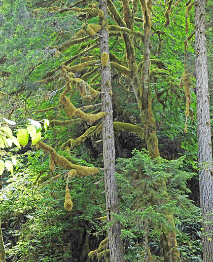
|
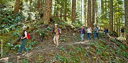
| Some segments have been restored for hiking and biking. The restored
segment runs for over 19 miles. It is accessible at several places
in addition to those listed below, including Forest Road 2000-245
(Burnside Road) 32 miles east of Sweet Home off Highway 20, turn
right and travel on spur 245 for 1.3 miles; and the Lost Prairie
Picnic Area: 38 miles east of Sweet Home off Highway 20. The Forest Service site Santiam Wagon Road lists several segments reproduced here. The segments have been renamed and somewhat restructured, but the trail remains the same; an enjoyable and mostly easy hike through a diverse forest experience. There are several campgrounds along the South Santiam River. In several of these campgrounds there will be a bridge or other opportunity to cross the River and intersect the Wagon Road Trail. |
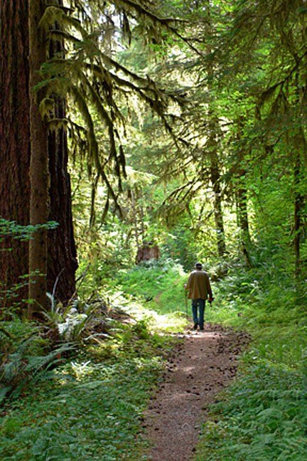
| The Santiam Wagon Road ran all along the Southern Fork of the
Santiam River. There are portions of the Wagon Road that can be
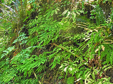
visited before the official trail starts at Mountain House. You can access this unofficial segment from the road marked for the Yukwah Campground. Turn south off Highway 20 onto this road. Shortly after the turn there is a fork in the road, with the left fork going into the campground. The right fork of the road crosses a bridge and turns left. At the point of the turn, a trail entrance is marked for a road that goes west. The east bound road runs up along the Santiam River across from the Yukwah Campground. The westbound segment goes up and down along the river, through typical riparian habitat of ferns, moss covered maples and mixed age trees. |
 |
 |
 |
 |
| Mountain House Segment Mountain House to Latiwi Creek Road Length: 3.3 miles Difficulty:Easy The western trailhead is just east of the Mountain House former restaurant (now a private residence) east of Sweethome on Highway 20. This trail travels along what is probably the most intact piece of the original wagon road. Most of the trail passes through relatively old second-growth forests, near to the mature river edge of the South Santiam River. Directions: Turn south off Hwy 20 at mile 53 (from Sweet Home Ranger Station, travel east on Highway 20 for 23.4 miles). Trailhead parking is just east of Soda Fork Creek: look for the Santiam Wagon Road sign. The trailhead is tucked into the trees on the south side of Highway 20 just east of Forest Road 2041. Sevenmile Segment. Latiwi Creek Road to Seven Mile Horse Camp Length: 3.3 miles Difficulty: Moderate This segment goes east along hillsides of second growth timber, with some patches of old-growth. The eastern segment follows the original route of the Wagon Road. This segment of the Road caused problems in the first transcontinental auto race in 1905, when the cars had to drag tree trunks to slow the cars as they descended Sevenmile Hill. This trail goes along the Santiam River and then Sevenmile creek to the east (up river) trailhead at the end of spur road 2000-024. About halfway along the trail, this trail is joined by a trail that takes off south of the House Rock campground. The western trailhead of this segment is on the south side of Highway 20, just past the Menagerie Wilderness area (to the north of Highway 20). The trail segment “ends” at the trailhead just past the Sevenmile campground. For the eastern trailhead from Sweet Home travel east on Highway 20 for 30 miles, then turn right on spur road 2000-024. Sevenmile Campground is part way along the spur. The spur ends at the trail head. Turn right on the trail for this segment. The map below shows the middle segment of the Santiam Wagon Road Trail. 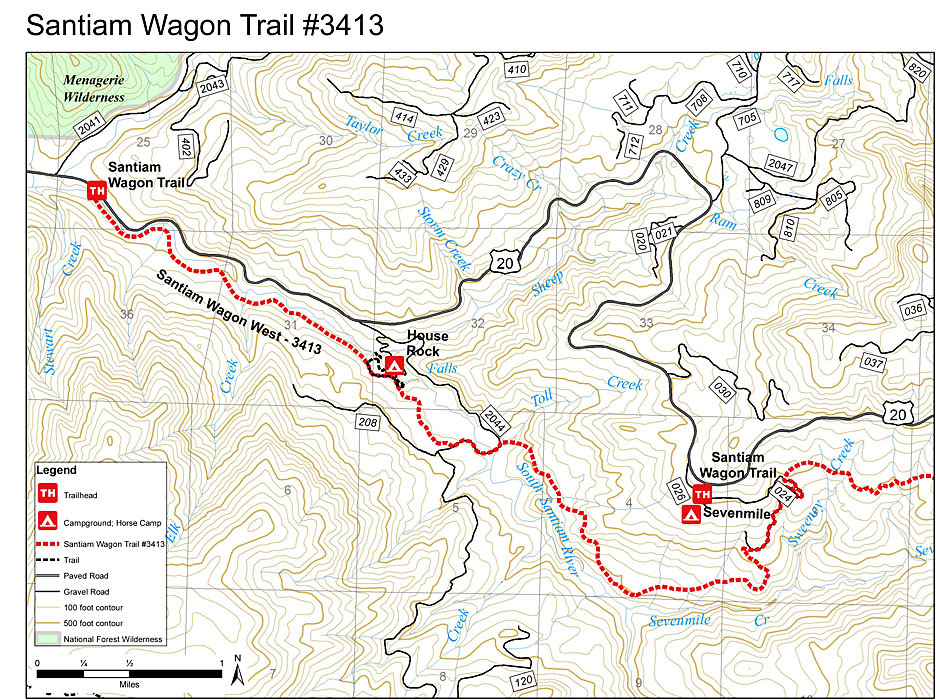
|