|
|
| HOME | PROTECTION | NATURE | PLAN YOUR VISIT | FAQ | JOIN/DONATE | ABOUT |
DOIN' THE DOUG - TRAIL GUIDES Browder Ridge Trail |
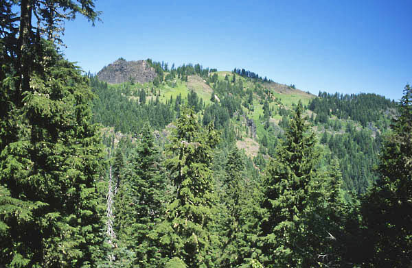 Photo courtesy of George Wuerthner. |
| Length: 3.7 miles one way Difficulty: Moderate/ Difficult Elevation Gain: 4,160 - 5,200 feet Forest Service Trail #3409 Site: Browder Ridge (no map) |
| There are two paths to Browder Ridge. This is the shorter trail.
The other, which William Sullivan numbers as trail # 14, is
designated by the Forest Service as a continuation of the Gate
Creek Trail. The Forest Service Browder Ridge Trail passes
through old-growth forest, alpine meadows and mature true fir
forests. It provides views of Mount Jefferson, Mount Washington and
the Three Sisters. The trail reaches a branch at about 5200
feet. The trail to the right is the Gate Creek Trail.
The trail to the left may be marked as the Heart Lake Trail.
However it is marked, take the left trail along the ridge toward
Hart Lake. The trail eventually reaches a crest in the ridge
where a short side trail goes towards Heart Lake. The trail ends
before the lake, but some dedicated fishers descend to the lake. It
may not be well marked, but the trail turns uphill to climb to the
summit of Browder Ridge. |
Directions: From Sweet Home, travel east on Highway 20 for 34
miles to Forest Road 15 (Deer Creek). This road is marked as paved.
Travel along Road 15 for 2.5 miles, then turn left onto spur road
080. This is a gravel road. The Forest Service has moved the
trailhead to this junction. Igt used to be down the gravel road 0.5
miles. |
Go to the Trail Guide
Go to the Browder Ridge page in Special Places